Climbing the Lemosho Route for 8 days starts on the Western side of Kilimanjaro at the Londorossi Gate. It was introduced as an alternative to the 6- and 7-day tours which begin at a higher, more challenging altitude. The path is slightly longer, spanning about 68 kilometers or 42.3 miles. Climbing the Lemosho Route for 8 days starts on the Western side of Kilimanjaro at the Londorossi Gate. It was introduced as an alternative to the 6- and 7-day tours which begin at a higher, more challenging altitude. The path is slightly longer, spanning about 68 kilometers or 42.3 miles.
Lemosho Route 8 Days Itinerary, Prices & Dates. For those who take the 8-day tour the Kilimanjaro success rate on the Lemosho Route is nearly 96%. Hikers can expect a beautiful rendezvous with some of the most stunning sights along with eclectic flora species. The cold and windy regions make the hike more challenging, which is why it is recommended to bear sufficient warm clothing on the way.

Welcome to Tanzania: Meet and greet at arrival point(usually at Kilimanjaro International Airport ,JRO) by our transfer and representative driver from Nduwa Tours who will escort you to the waiting vehicle for loading your luggage then drive you to the Hotel in Arusha town. You will meet our representative who will show up at the Airport with a sign board with your name and a warm smile on his/her face when welcoming you to Tanzania. After checking in at the hotel you will get a briefing about your next day’s 9 Days Lemosho Route without Crater Camping then your mountain guide will check/inspect your climbing gears. The rest of the day can be spent relaxing at the pool or exploring the town of Arusha.
Accommodation: Mid-Range Hotel in Arusha on Bed & Breakfast Basis
We depart Arusha for Londorossi Gate, which takes about 4 hours, where you will complete entry formalities. Then drive to the Lemosho trailhead. Upon arrival at trailhead, we begin hiking through undisturbed forest which winds to the first camp site.
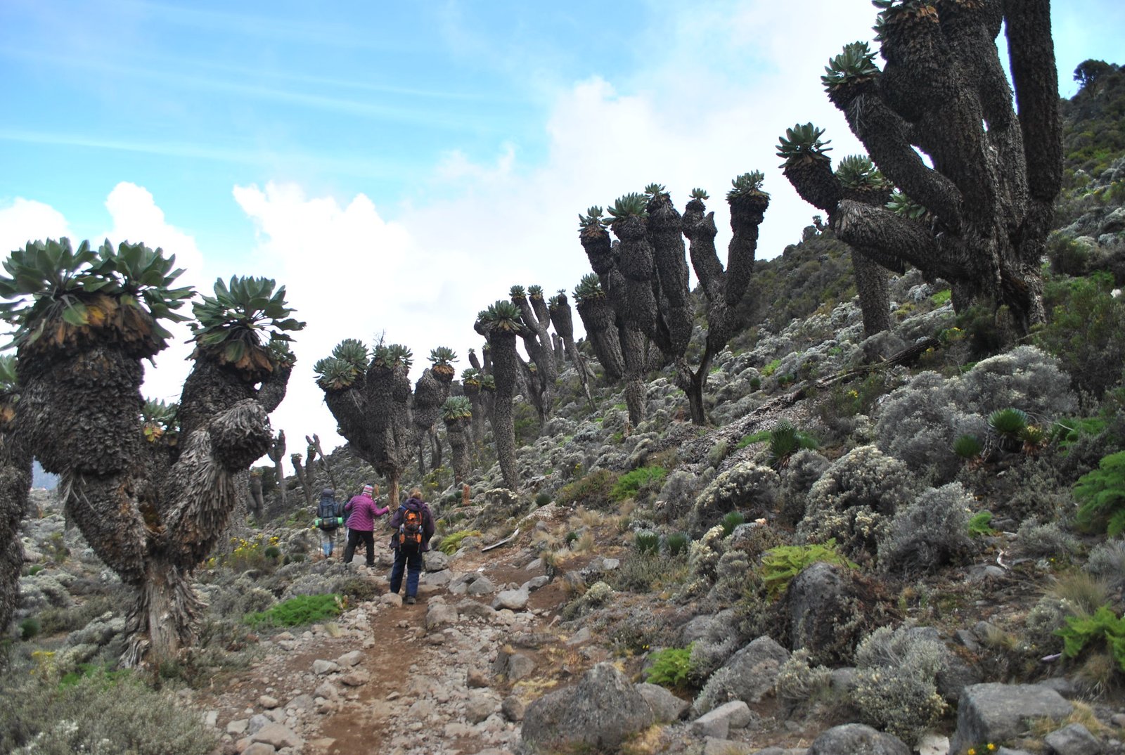
We continue on the trail leading out of the rain forest and into a savannah of tall grasses, heather and volcanic rock draped with lichen beards. As we ascend through the lush rolling hills and cross several streams, we reach the Shira Ridge before dropping gently down to Shira 1 Camp. Here we catch our first glimpse of Kibo across the plateau.
We explore the Shira Plateau for a full day. It is a gentle walk east on moorland meadows towards Shira 2 Camp. Then we divert from the main trail to Moir Hut, a little used site on the base of Lent Hills. A variety of walks are available on Lent Hills making this an excellent acclimatization opportunity. Shira Plateau is one of the highest plateaus on earth.
We begin the day climbing up a ridge and then head southeast towards the Lava Tower – a 300 ft tall volcanic rock formation. We descend down to Barranco Camp through the strange but beautiful Senecio Forest to an altitude of 13,000 ft. Although you begin and end the day at the same elevation, the time spent at higher altitude is very beneficial for acclimatization.
We begin the day by descending into a ravine to the base of the Great Barranco Wall. Then we climb the non-technical but steep, nearly 900 ft cliff. From the top of the Barranco Wall we cross a series of hills and valleys until we descend sharply into Karanga Valley. One steeper climb up leads us to Karanga Camp. This is a shorter day meant for acclimatization.
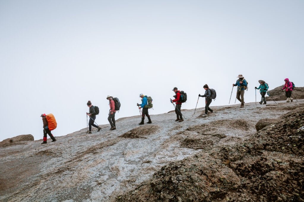
We leave Karanga and hit the junction which connects with the Mweka Trail. We continue up to the rocky section to Barafu Hut. At this point, you have completed the Southern Circuit, which offers views of the summit from many different angles. Here we make camp, rest and enjoy an early dinner to prepare for the summit day. The two peaks of Mawenzi and Kibo are viewable from this position.
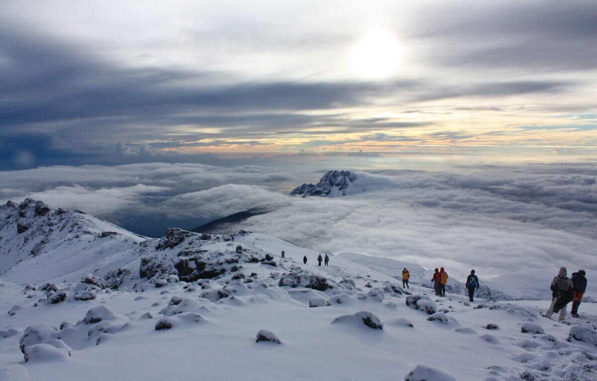
Very early in the morning (around midnight), we begin our push to the summit. This is the most mentally and physically challenging portion of the trek. The wind and cold at this elevation and time of day can be extreme. We ascend in the darkness for several hours while taking frequent, but short, breaks. Near Stella Point (18,900 ft), you will be rewarded with the most magnificent sunrise you are ever likely to see coming over Mawenzi Peak. Finally, we arrive at Uhuru Peak- the highest point on Mount Kilimanjaro and the continent of Africa.
From the summit, we now make our descent continuing straight down to the Mweka Hut camp site, stopping at Barafu for lunch. The trail is very rocky and can be quite hard on the knees; trekking poles are helpful. Mweka Camp is situated in the upper forest and mist or rain can be expected in the late afternoon. Later in the evening, we enjoy our last dinner on the mountain and a well-earned sleep.
Barafu Camp to Uhuru Peak
Elevation: 15,331 ft to 19,341 ft
Distance: 5 km/3 miles
Hiking Time: 7-8 hours
Habitat: Arctic
Uhuru Peak to Mweka Camp
Elevation: 19,341 ft to 10,065 ft
Distance: 12 km/7 miles
Hiking Time: 4-6 hours
Habitat: Rain Forest
On our last day, we continue the descent to Mweka Gate and collect the summit certificates. At lower elevations, it can be wet and muddy. From the gate, we continue another hour to Mweka Village. A vehicle will meet us at Mweka Village to drive us back to the hotel in Arusha.
Meal Plan: Lunch on route either hot lunch or packed lunch.
The day is left free to wind down after the trek before your flight home. Depending on flight times you could go and explore Arusha town and grab some souvenirs before heading to the airport.

Request a safari quote now and our safari expert will be in touch with you within 24 hours.
Office Location
P.O.Box 14006 , Arusha - Tanzania
+255 763 962 447
+255 786 539 344
Email Address
info@nduwatours.com sales@nduwatours.com
Cash in USD,EUROS & C,DOLLAR
NB: You will receive invoice before payment and you will get a receipt soon after paymnet.